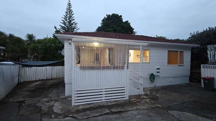
Nestled in the heart of Pakuranga Heights, this delightful 2-bedroom home at 16A Rotoiti Avenue offers a blend of comfort and convenience, perfect for those seeking a serene living space. The property features a Healthy Homes compliant environment, ensuring a safe and healthy standard of living. Pet lovers will rejoice as this home welcomes furry friends, allowing you to share your space with the whole family.
Inside, the air conditioning system provides year-round comfort, while each bedroom boasts a built-in wardrobe for easy organisation. The living area extends onto a beautiful deck, ideal for soaking up the sun or hosting barbecues. A lush garden adds to the appeal, presenting the perfect spot for relaxation or play. With 2 dedicated parking spots, vehicle storage is a breeze.
Situated in a friendly community, you'll find local amenities just a stone's throw away. Enjoy the convenience of nearby shops, parks, and schools, making daily life both easy and enjoyable. At $560 per week with a bond of $2240, this charming residence combines affordability with the perks of a sought-after Auckland location. It's more than a house; it's a place to call home.
Features: Pets allowed, Garden, Deck, Built-in wardrobe, Air conditioning, Healthy Homes compliant
Upcoming open homes: Sat, May 16 - 9:30am - 9:45am (Booking required)TENANTS: To apply or schedule a viewing please click the email button to contact the landlord directly.
LANDLORDS: myRent.co.nz provides a cheaper solution to get your property in front of more potential tenants. We also offer property management for just $20/month.