***To register for viewings please click on "book a viewing time" on the Barfoot & Thompson Howick website. Enter your contact details and you will automatcially be updated when a viewing time is available***
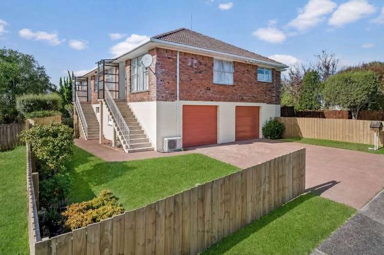
This double storey home offers the following;
Upstairs;
-Two good sized bedrooms
-Spacious living/dining area with heat pump
-One bathroom with shower over bath, vanity & toilet.
-Kitchen with separate laundry room
Downstairs;
-Larger than normal single garage
-Workshop area inside the garage
-One off street parking in front of the garage
-Enclosed garden
No smoking.
School zones: Pakuranga Intermediate, Edgewater College.
Move in costs required in advance;
1 weeks rent = $540
4 weeks bond = $2160
TOTAL = $2700.00
Feel free to view the property from the roadside, however please do not enter the property under any circumstances unless you are with a Barfoot & Thompson agent. When arriving for the viewing please park on the roadside and do not park on the driveway.
For more info please call/text: Brooke - 027 836 2814
***To register for viewings please click on "book a viewing time" on the Barfoots website, enter your contact details and you will automatcially be updated when viewing time is available***
For further listings, please refer to the link below
http://www.barfoot.co.nz/Branches/howick/Rentals
Landlords:
Barfoot and Thompson Howick offers Rental Appraisals, Casual Letting and Full Property Management Solutions. Please give Taryn a call today to discuss your Property Management requirements. Ph: 09 535 8762 or 027 836 2814 E: [email protected]
Beware of Scams: Barfoot & Thompson does not ask for money in emails without undertaking the full application process, checks and tenancy agreements being drawn up. Payment can be made at a branch or to our BNZ account supplied inside the tenancy agreement. If you are unsure if a request is legitimate, please phone the branch and check with the Property Manager.
*** Please register online at barfoot.co.nz for available viewing times ***
See this listing on Barfoot & Thompson