To book a viewing or make an application, please paste the below link into your browser: https://www.goodwins.co.nz/property/beachlands/18-kanae-drive/
*If no times are currently available, please register your details to be notified as soon as viewings become available*
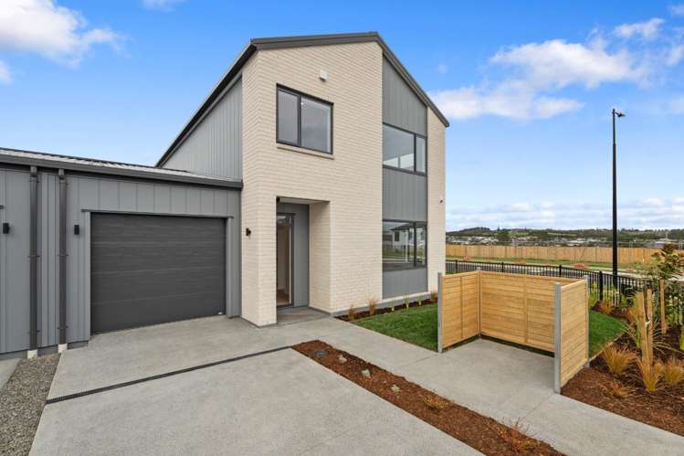
Don't miss your chance to be the very first to live in this stunning, brand new four-bedroom home in the highly sought-after seaside suburb of Beachlands — where coastal charm meets modern luxury living!
Step into a beautifully spacious open plan living and dining area on the lower level, where large sliding doors flow seamlessly out to a generous, fully fenced rear section. This outdoor space is truly one of the standout features of the home, and it's just waiting for you to enjoy it!
The sleek, modern kitchen is fully equipped with quality appliances and thoughtfully designed for effortless everyday living. Whether it's weeknight dinners or weekend feasts, this kitchen delivers.
A large office or media room offers the perfect setup for working from home or a second living space — the choice is yours! A powder room and dedicated laundry complete the lower level with practical everyday convenience.
Head upstairs to find four spacious double bedrooms, including a stunning master suite with a walk-in wardrobe and private ensuite — your own personal retreat. A second bedroom boasts a super-sized wardrobe for exceptional extra storage, while a handy study nook keeps everyone organised.
The beautifully appointed main bathroom features both a bath and walk-in shower, plus a separate toilet for busy household mornings.
A fully carpeted tandem internal-access garage, complete with an EV charger plus additional off-street parking means there's room for the whole family and your electric vehicle too!
Built to an exceptional standard in a warm, family-friendly neighbourhood, this home places you just minutes from Formosa Golf Club and Pine Harbour Marina, with a convenient ferry commute straight into Auckland CBD.
Beachlands is celebrated for its stunning coastal walkways, beautiful scenic reserves, and that enviable relaxed seaside lifestyle — this is coastal living at its absolute finest!
For more information, we invite you to contact Raewyn Millington on 021 278 7526 or [email protected]
If viewing ‘Trademe’ on a mobile device please scroll to bottom of the page and click “View Agency Website” to book a viewing or make an application.
PLEASE NOTE: The technical information provided (including floor plan & section sizes, for example) has been sourced from third-party organisations such as Cotality, LINZ, and Auckland Council. It is provided as a broad guide for general information, only.
BEWARE OF SCAMS: Please note Goodwins will never request any payment prior to viewing a property. Please always ensure the person you're dealing with is a verified Goodwins Employee. If you're unsure, please call our office to verify - 09 3734400